


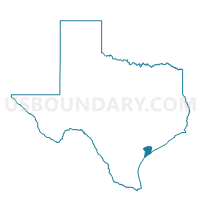
Voting District 0019, Calhoun County, Texas
About
Outline

Summary
| Unique Area Identifier | 671277 |
| Name | Voting District 0019 |
| County | Calhoun County |
| State | Texas |
| Area (square miles) | 154.51 |
| Land Area (square miles) | 45.93 |
| Water Area (square miles) | 108.58 |
| % of Land Area | 29.73 |
| % of Water Area | 70.27 |
| Latitude of the Internal Point | 28.61436390 |
| Longtitude of the Internal Point | -96.43323750 |
Maps


Graphs
Select a template below for downloading or customizing gragh for Voting District 0019, Calhoun County, Texas


Neighbors
Neighoring Voting District (by Name) Neighboring Voting District on the Map
- Voting District 0004, Jackson County, TX
- Voting District 0006, Calhoun County, TX
- Voting District 0007, Matagorda County, TX
- Voting District 0008, Jackson County, TX
- Voting District 0009, Jackson County, TX
- Voting District 0018, Calhoun County, TX
- Voting District 0025, Calhoun County, TX
- Voting District 003B, Matagorda County, TX
Top 10 Neighboring County Subdivision (by Population) Neighboring County Subdivision on the Map
- Port Lavaca CCD, Calhoun County, TX (14,769)
- Palacios CCD, Matagorda County, TX (5,749)
- Seadrift CCD, Calhoun County, TX (3,888)
- La Ward-Lolita CCD, Jackson County, TX (2,211)
- Point Comfort CCD, Calhoun County, TX (1,454)
Top 10 Neighboring Unified School District (by Population) Neighboring Unified School District on the Map
- Calhoun County Independent School District, TX (21,381)
- Palacios Independent School District, TX (6,825)
Top 10 Neighboring State Legislative District Lower Chamber (by Population) Neighboring State Legislative District Lower Chamber on the Map
- State House District 29, TX (208,164)
- State House District 32, TX (157,055)
- State House District 30, TX (147,611)
Top 10 Neighboring State Legislative District Upper Chamber (by Population) Neighboring State Legislative District Upper Chamber on the Map
Top 10 Neighboring 111th Congressional District (by Population) Neighboring 111th Congressional District on the Map
Top 10 Neighboring Census Tract (by Population) Neighboring Census Tract on the Map
- Census Tract 4, Calhoun County, TX (6,255)
- Census Tract 7306, Matagorda County, TX (5,749)
- Census Tract 9501, Jackson County, TX (5,342)
- Census Tract 5, Calhoun County, TX (3,888)
- Census Tract 3, Calhoun County, TX (1,454)
Top 10 Neighboring 5-Digit ZIP Code Tabulation Area (by Population) Neighboring 5-Digit ZIP Code Tabulation Area on the Map
- 77979, TX (17,144)
- 77465, TX (7,161)
- 77983, TX (2,209)
- 77982, TX (1,253)
- 77978, TX (743)
- 77428, TX (61)